Strong El Niño Will Weaken and Could Transition to La Niña This Fall, NOAA Says
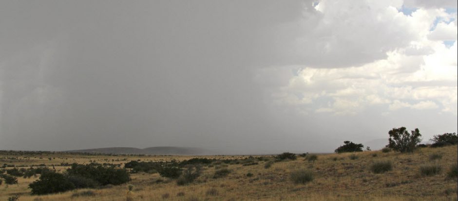
This will likely mean renewed drought in far-West Texas.
NOTE: this post initially appeared on Weather.com on February 11, 2016
El Niño is forecast to weaken through the spring with conditions in the equatorial Pacific Ocean potentially transitioning to La Niña next fall, according to the latest monthly outlook issued Thursday by NOAA.
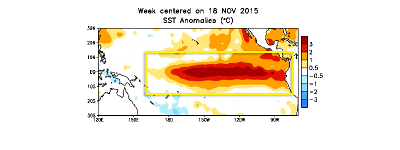
Sea-surface water temperatures (SST) in the equatorial east and central Pacific Ocean were still well above average during January, indicating strong El Niño conditions remained in place. Water temperatures appeared to reach their peak in mid-November, but have been cooling slowly the last couple of months, according to fine-resolution weekly SST data from NOAA’s Climate Prediction Center.
Citing the latest model guidance, NOAA/CPC said Thursday El Niño, as it typically does, will continue to weaken through the spring, eventually disappearing by late spring or early summer. This means sea-surface water temperatures in the equatorial central and eastern Pacific Ocean will return to near-average levels (neutral conditions) from their current above-average state.
Though El Niño is forecast to weaken, NOAA said that we will continue to see temperature and precipitation impacts through late winter and into spring in the United States and elsewhere. You can find more information on those impacts at the bottom of this article.
La Niña Conditions Arriving in the Fall?
After transitioning to neutral conditions, it’s possible that sea-surface water temperatures in the equatorial east and central Pacific Ocean could continue to cool to the point that La Niña may emerge in the fall, NOAA said. However, they cautioned that much uncertainty remains, though there is computer model and physical evidence that La Niña conditions could develop.
La Niña is the opposite of El Niño, namely, a cooling of the equatorial east-central Pacific Ocean.
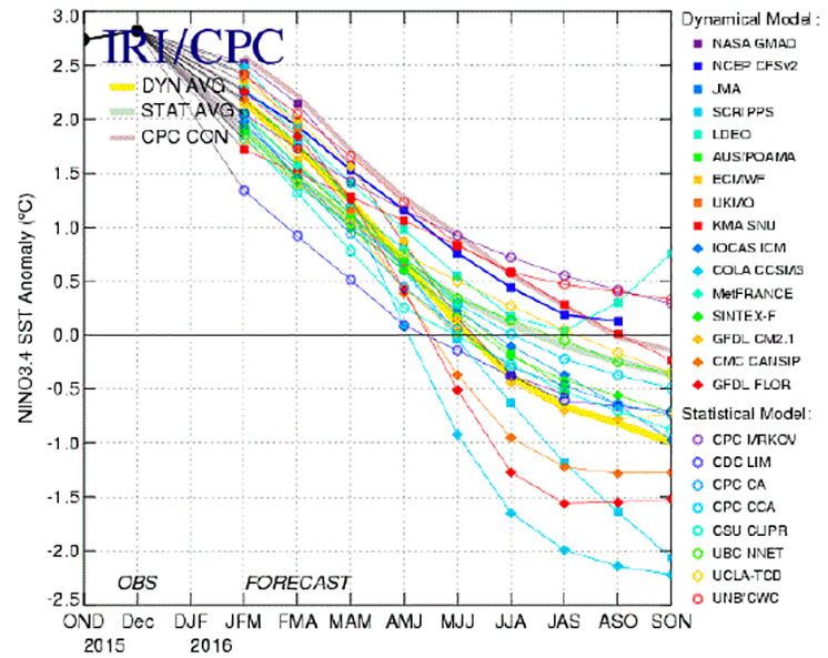
Of course, if La Niña does develop, the strength of it (weak, moderate or strong) will determine what impacts it may have on the weather in North America and elsewhere next winter (2016-2017). The downward trend in the graph lines from left to right below illustrates the computer model forecast for cooling SSTs through spring, summer and into next fall.
During a strong La Niña, impacts are nearly the opposite from El Niño during late fall and winter.
The southern tier of the United States typically sees drier than average conditions, while much of the Pacific Northwest and Ohio Valley are wetter than average.
For temperatures, a swath from the northern Plains to the Pacific Northwest sees below-average temperatures overall. The South, mid-Atlantic and Ohio Valley see temperatures that are above-average.
El Niño’s Potential Late Winter/Spring Weather Impacts
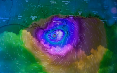
 El Niño is an anomalous, yet periodic, warming of the central and eastern equatorial Pacific Ocean. For reasons still not well understood, every two to seven years, this patch of ocean warms for 9 to 18 months, then cools.
Precipitation and temperature impacts in the U.S. from a strong El Niño are typically most noticeable during the colder months, from late fall through winter, a bit less so in the spring.
It’s also important to keep in mind:
1) El Niño is not the sole driver of the atmosphere at any time. Day-to-day variability in the weather pattern, including blocking patterns, forcing from climate change and other factors all work together with El Niño to determine the overall weather experienced over the timeframe of a few months.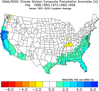
2) No two El Niños are exactly alike.
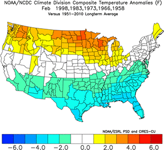
Looking at past strong El Niños, as classified by consultant meteorologist Jan Null, here are the most consistent signals we’ve seen in the data for temperatures and precipitation from February through May in the U.S.:
– Wetter: California, most of the Great Basin and Desert Southwest; Lower Mississippi Valley, Southeast and most of the East Coast
– Drier: From western Washington into the Northern Rockies and Northern Plains
– Cooler: Much of the southern half of the nation, from California to the Carolinas
– Warmer: Northern tier of states from the Pacific Northwest to the Northern Plains, northern Great Lakes, and northern New England.
While it’s well known strong El Niño winters can be wet in California and the Southeast, it’s interesting to note how wet past springs have been even as the El Niño weakens.
A rather large swath of the South, Ohio Valley and Northeast has been wetter than average in April. In the Tennessee Valley, that wetness has tended to lag into May, as well.
Four out of the five February through May periods during or after strong El Niños have been wetter than average in the Northeast I-95 corridor.
Temperature-wise, the general warmer-than-average North/cooler-than-average South scenario tended to break down somewhat by April.
In fact, post-strong El Niño Aprils of the past were downright cold in parts of the Plains and Rockies. Stubbornly cool conditions lagged into May in the Great Lakes, Ohio Valley and Northeast.
With investments, past performance doesn’t guarantee future results. So, while these impacts have tended to occur in the winters and springs of strong El Niños, factors such as day-to-day variability, blocking of the jet stream, even climate change will also play a role in your overall weather into spring 2016.
Just when we were getting used to good quail hunting!